Public Hunting Land
in Florida

Map Showing Florida Wildlife Management Areas
(click to enlarge)
Florida National Forest Motor Vehicle Use Maps for Apalachicola, Ocala, and Osceola National Forests
(click to view map page)
FLORIDA WILDLIFE MANAGEMENT AREAS
2016 - 2017 Regulation Brochures and Maps
NORTHWEST REGION:
NORTH CENTRAL REGION:
NORTHEAST REGION:
SOUTHWEST REGION:
SOUTH REGION:
|
Allapattah Flats |
Everglades |
Okaloacoochee Slough |
|
Big Cypress |
Fisheating Creek |
Picayune Strand |
|
CREW |
Holey Land |
Rotenberger |
|
Dinner Island Dupuis |
Hungryland JW Corbett |
Southern Glades Spirit-of-the-Wild |
The public hunting land of the great outdoors of North Florida gets under your skin. There are numerous wildlife management areas to keep you hunting in Florida all season long.
There's the familiar whiff of deer hunting in the autumn air. That woodsy aroma entices you into the wild lands. I'm sure you will agree that there is nearly nothing as good as fresh air and sunshine. Take the river or the road as your pathway through your chosen area.
As you can see for yourself, the public hunting land of the Apalachicola National Forest is waiting just for you . . .

Don't let the flowing Ochlockonee River pass you by. . . .

It's time to pack your gear and say good-bye to the wife. "Heck no," I say. Don't leave her behind. Tell her to grab her guns and fetch a few more bullets, too.
You're packed, she's packed. You're almost at the locked and loaded point. It's time to head on out. "Out where," you ask? It's simple. There are many public hunting land Wildlife Management Areas (WMAs) in Northwest Florida that are open to public hunting. Check out the following Wildlife Management Areas.
Florida Fish and Wildlife Conservation Commission
U.S. Department of Agriculture, Forestry Service
U.S. Fish and Wildlife Service

What's New
-
Shooting Ranges open to the public in Northwest Florida
Aug 09, 16 01:39 PM
-
Hunting Articles by Tony Young, Outta the Woods, August 2016
Aug 01, 16 06:02 PM
-
2016 Upcoming Gun Shows
Jul 23, 16 11:33 AM
Great Reading!
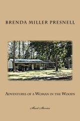
"Adventures of a Woman in the Woods"
[Short Stories]


Children's Book
ages 9-14
Paperback Edition
Kindle Edition
Submit YOUR photo!


Florida FWC 2016-2017
Hunting Regulations Handbook
Hunting License and
Permits Information
|
What others are saying about our site:
|